 Joey sitting on his new bike outside tent cabin #549 where we spent three nights in Yosemite. This is in the campground once known as Curry Village, but now rebranded as Half Dome Village after a trademark dispute with the prior concessionaire.  Half Dome towers above us. It was once a full dome, but was cut in half by a billion-ton glacier millions of years ago. 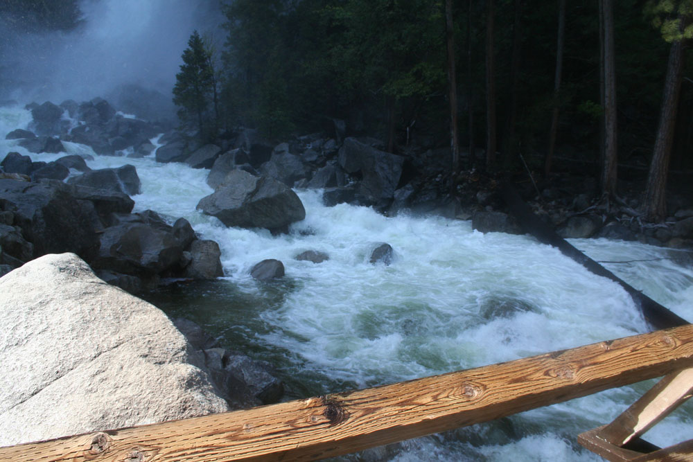 We decided to go for a walk up to the base of Yosemite Falls. The water flow was the highest I haver ever seen it, and I've been coming here my whole life. 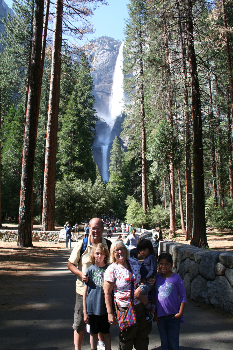 A family portrait for posterity. Upper and lower Yosemite falls can be heard a mile away.   Hard to get lost on a trail that is 20 feet wide. 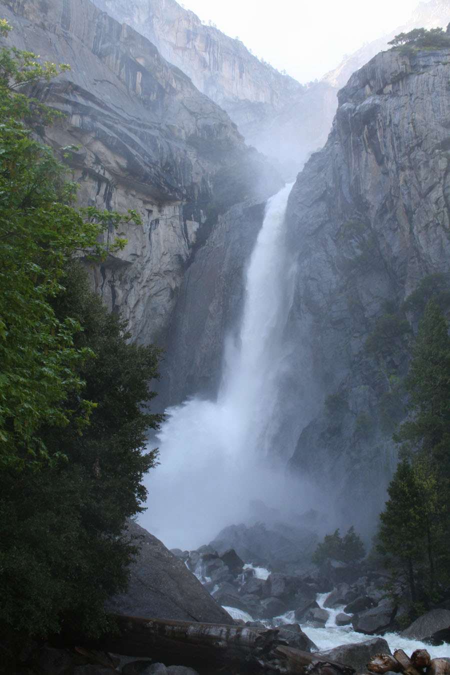 As we approached the falls, Joey asked, "What is all that dust?" We informed him that the "dust" was actually water mist thrown into the air by the crashing water. So fun to observe kids learning new things.  A boy who loves his mother.
0 Comments
The last time I visited Calico Ghost Town I was about ten or eleven years old -- here's a photo of that day, circa 1963. L - R: Stephen, me, mom, Monica. Looks like it was cold that day.  Now flash forward half a century.  The Next Generation of Calico visitors. L - R: Joey, Dalton, Marijane.  Belly up to the sand bar, boys !!  We all have Walter Knott (of Knott's Berry Farm fame) to thank for the preservation of Calico Ghost Town. 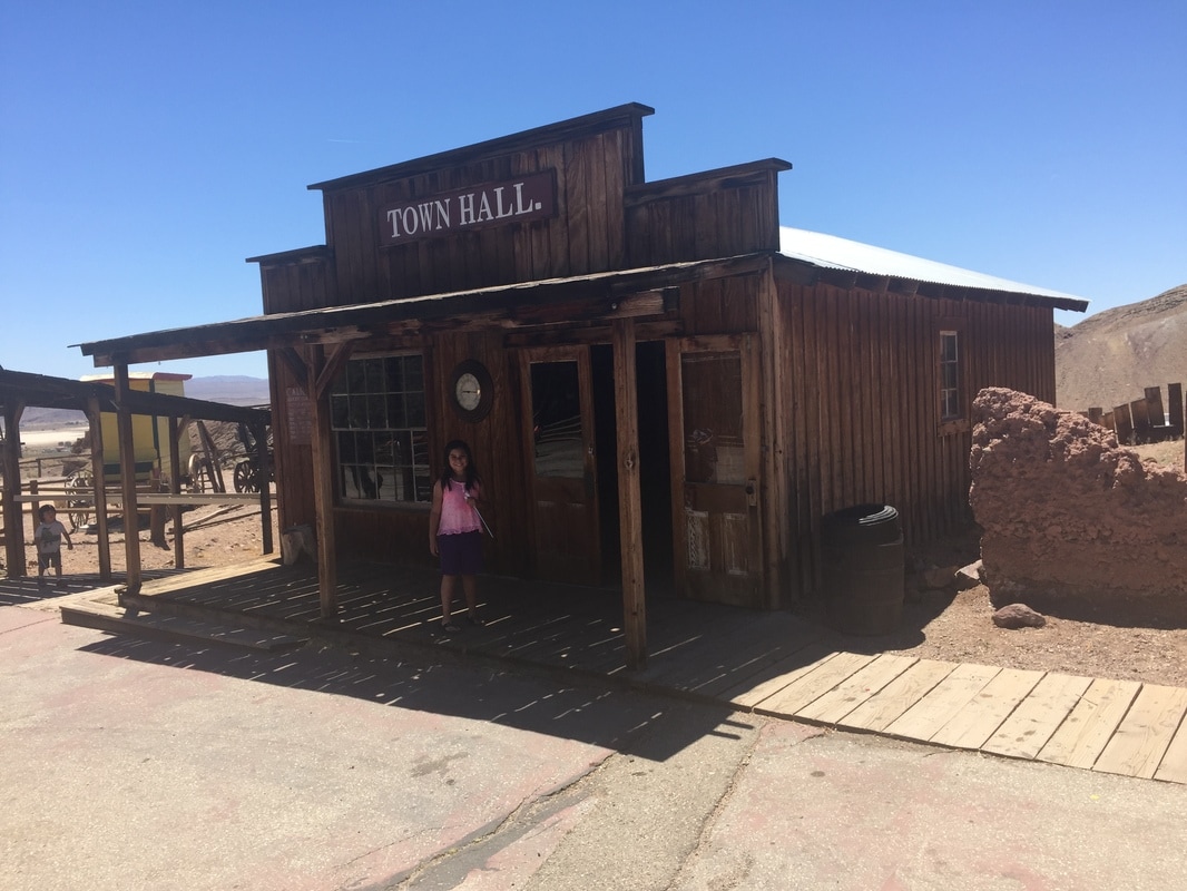 Small town -- small town hall.  "Saloon" signs are everywhere in Calico. So are "Keep Out" signs.  Dalton met a new friend at our camp -- Devin (with glasses and Dalton's arm around his shoulder). Here they take a Chinese bath.     A final tune (Taps, perhaps?) as we bid Calico adieu.
This entry is a little out of sequence due to a phone problem -- I went swimming with my iPhone 6+ in my pocket, and the phone got zapped. Consequently I lost all my non-uploaded photos, which consisted mainly of photos of our visit to Grand Canyon Caverns. So the photos pasted here are generic internet photos -- not my usual quality. Grand Canyon Caverns is actually about 100 miles from the Grand Canyon. We could accuse them of riffing on the popular national park's name, but it turns out there is a valid reason for calling it Grand Canyon Caverns. Years ago the cave owners wanted to see where the air currents led since they knew 95% of the cave had not been explored, yet fresh air was coming and going in large quantities. So they set off daily red smoke bombs in the cave and watched for the smoke to come out of the surface. They never saw any smoke, but two weeks later the rangers at Grand Canyon reported red smoke coming out of crevices in the Grand Canyon walls -- 100 miles away !! So they changed the name to Grand Canyon Caverns from whatever it was before. 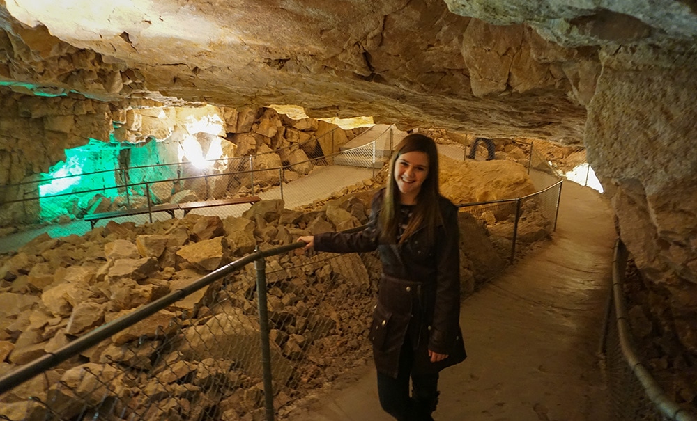 Our guide, Justine. Nice girl, but unable to answer half my questions with anything beyond, "That was a good question." 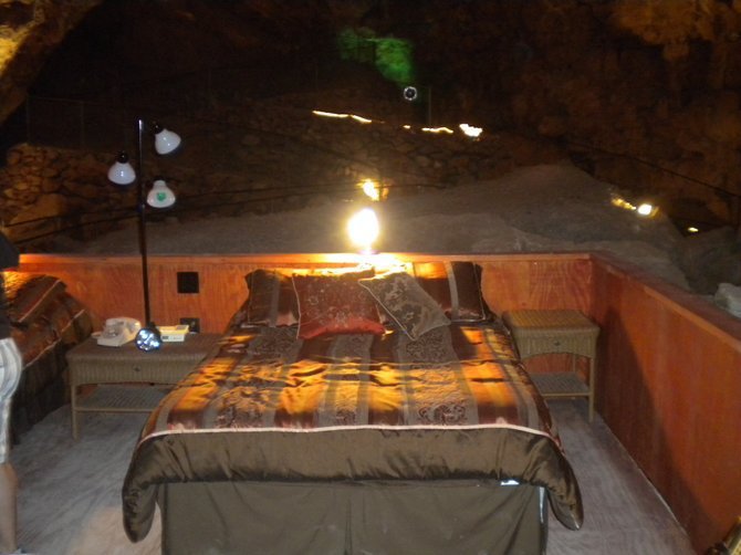 For $850 per night you and a significant other can spend a night inside the cave. How do you know when it's morning when its pitch black in the cave 24/7? Justine didn't know. 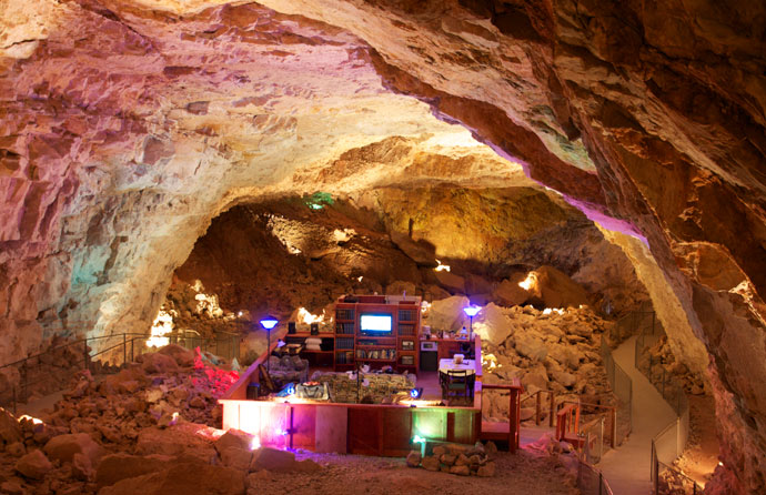 A wider view of your future bedroom. 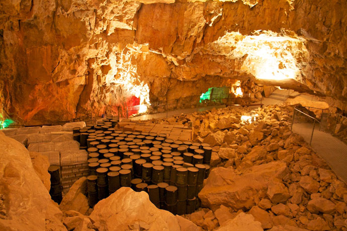 President Kennedy named the caverns an official federal fallout shelter. It's stocked with months of water and MRE's. This is where your politicians will go when the nuclear war starts.
Two days ago we risked life and limb to take our 30-foot trailer up a crazy, narrow, winding mountain road to reach the ghost town of Oatman, Arizona -- a must-see stop for those exploring Historic Route 66. We wanted to see the famous feral burros that inhabit the town. When the gold ran out in Oatman in the early 1900's, the miners left town, and left a number of burros behind. About two dozen descendents of those burros have made the main street of Oatman their home.    The four-footed panhandlers come right onto the sidewalk if they think you have a treat for them.    We had lunch here.  That's a real life out-of-order piano-playing dummy.  Every day at noon and 2:30 there's a dorky shoot-out with dorky dialogue.  The shootouts are sponsored and performed by (I'm not making this up) the Shriners. 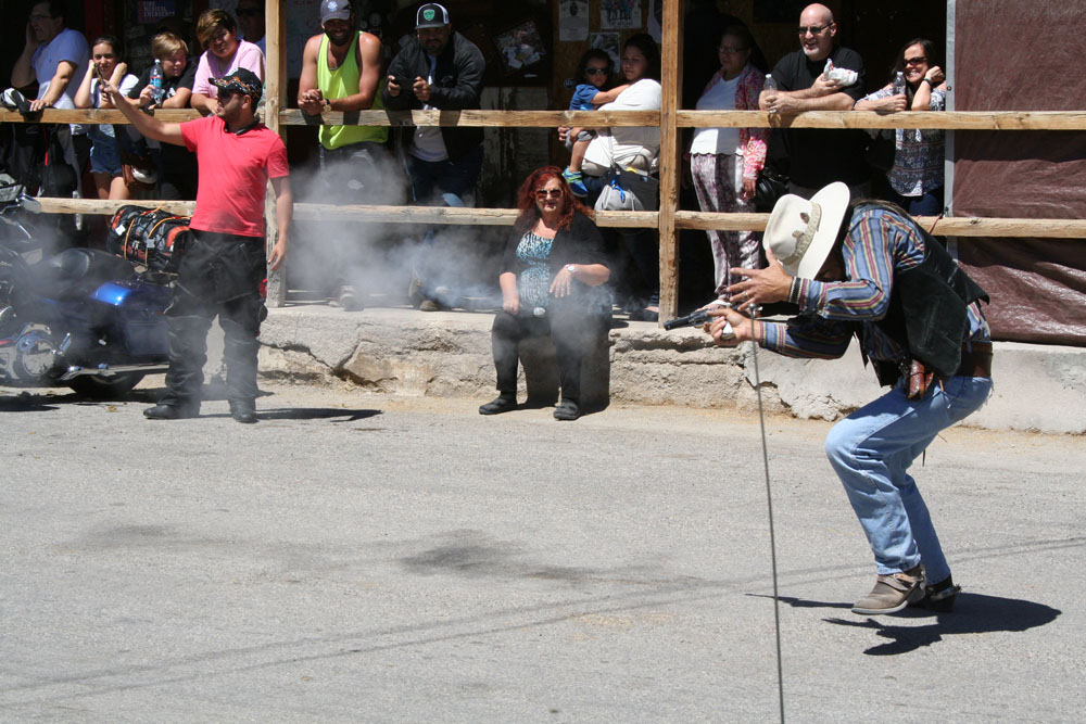 POW !!  The bad guy goes down... 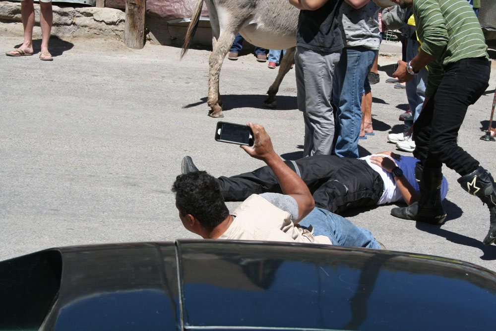 And so do a couple of audience members. Ha ha.  The dorkiness even extends to the wall murals.
Finally can post again now that we are at a place with decent wifi -- the KOA near Calico Ghost Town. The Grand Canyon is, of course, a geologic wonder. One of the things that we learned that surprised me was that it is "only" 6 million years old. Something that big I just assumed took hundreds of millions of years to carve out -- dinosaur-type time. Not so, apparently. As geologic time goes, the Grand Canyon is a youngster. 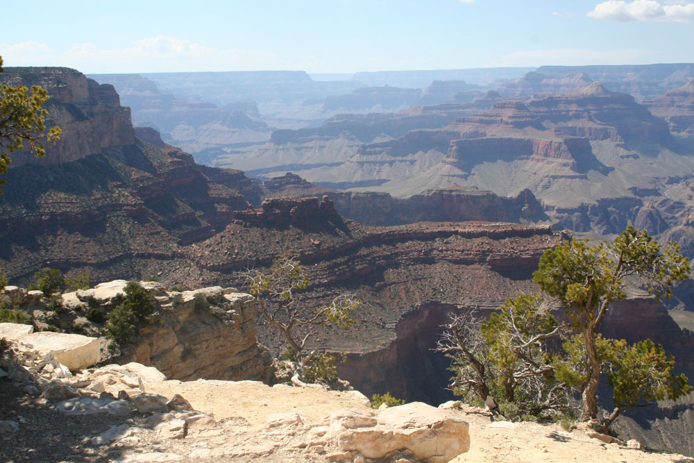    Telescopes are spaced around the Trail of Time to focus in on special geologic formations. Very educational.   Joey insisted on carrying the backpack -- which was loaded down with 15 pounds of water.  Though the canyon itself is only 6 million years old, its rocks are ancient. 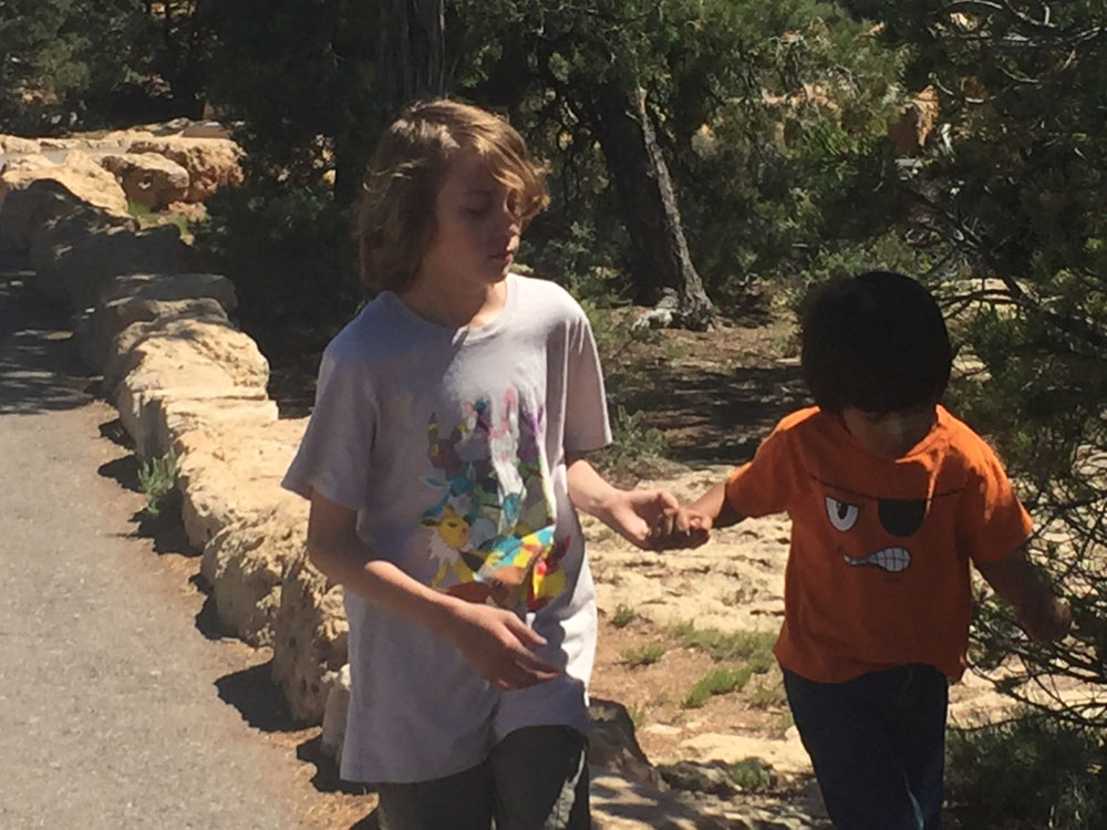 Dalton helps Joey climb some of those ancient rocks.  Every few yards yields another spectacular view.   After we were done with the Trail of Time, Marijane decided to check out the famous Grand Canyon mules.
It's been 10 days since our last post -- attributable to the inadequate wifi available in the Grand Canyon area. We are now camped at the KOA in Seligman, Arizona, which has a good, but not great, wifi signal. The Grand Canyon, more than any other place we have visited, resisted being well photographed. It's just too massive to capture in a small two-dimensional photo. Even so, we're going to give it a try. We camped in Mather Campground. One of the first things we noticed is that the local elk population likes to pass through this campground every morning and evening -- and our campsite seemed to lie smack dab in the middle of their migratory journeys.  That's my lawn chair she's passing in front of.  Inclement weather has followed us everywhere on this trip. Here we are well into spring and we were hit with a rain/sleet/snow/hail/wind storm, which lasted for a full day. At least we got some homeschooling done.  Because of the weather and homeschooling requirements we only got to spend one day sightseeing. We decided to hike the 1.5 mile Trail of Time which follows a section of the South Rim Trail. The above photo and those that follow in this post were taken from that trail.      Above: The Kaibab Trail snakes and switchbacks its way downward toward the bottom of the 5,000 foot high canyon and its creator: the Colorado River.
Next Post: More on the Trail of Time. And after that we'll be posting about exploring a section of Route 66: The Mother Road. Much of the park is closed prior to the middle of May so we were limited on what we could see and do. Stopping by the museum at the south end of the park we took a small walk down to a cliff dwelling called Spruce Tree House. Due to rock falls from the sandstone overhang above the dwelling, you can only observe Spruce Tree House from across the canyon.    Zachary examines a kiva at the Far View site -- a large set of ruins atop the mesa. Most Native American dwellings in Mesa Verde are actually on flat land -- only a smaller percentage hug the cliff faces. 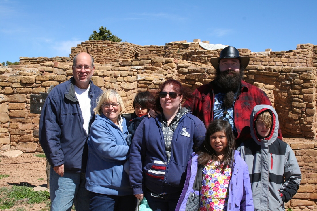 There's always time for a quick family photo.  Square Tower House after undergoing a major restoration project.  This sign illustrates where four cliff dwellings are located near each other in one of the many park canyons.  Lisa points out one of those dwellings.  Back at camp, Zachary instructs Dalton in the fine art of log splitting.  One last group photo before Kristin and Zachary head home to SLC.
|
